Know the place. Remember the PATH.
A landmark-led wayfinding proposal for Toronto's underground PATH network. Started at OCAD University in 2020, rebuilt in 2026.
- Client
- OCAD University project, revisited
- My role
- Concept, map and signage design. Research with Aashish Arora.

The problem
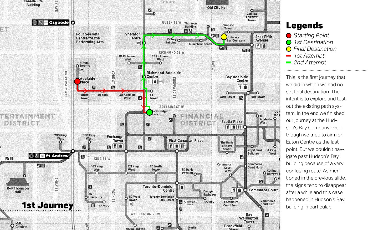
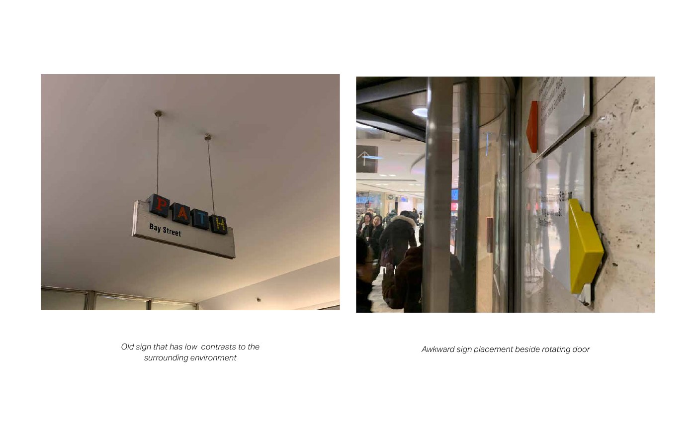
In 2020, Aashish Arora and I walked three journeys through PATH, Toronto's underground walkway network, and recorded what happened. We made wrong turns, followed signs that pointed one way and then stopped, and found a sign you could barely see beside a revolving door.
The problems were mostly about continuity. A sign told us where to go but not what to do at the next decision point.
What I decided
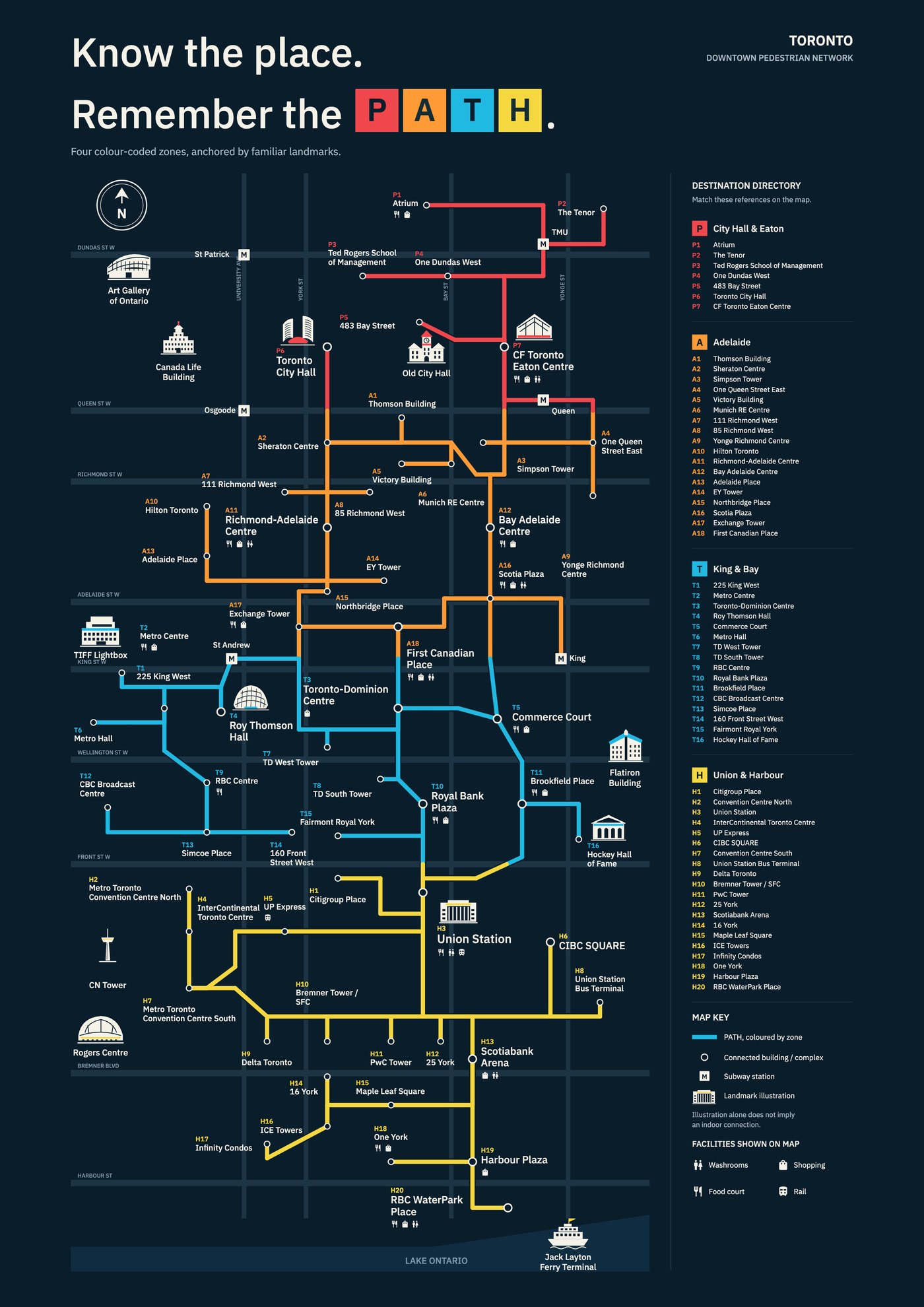
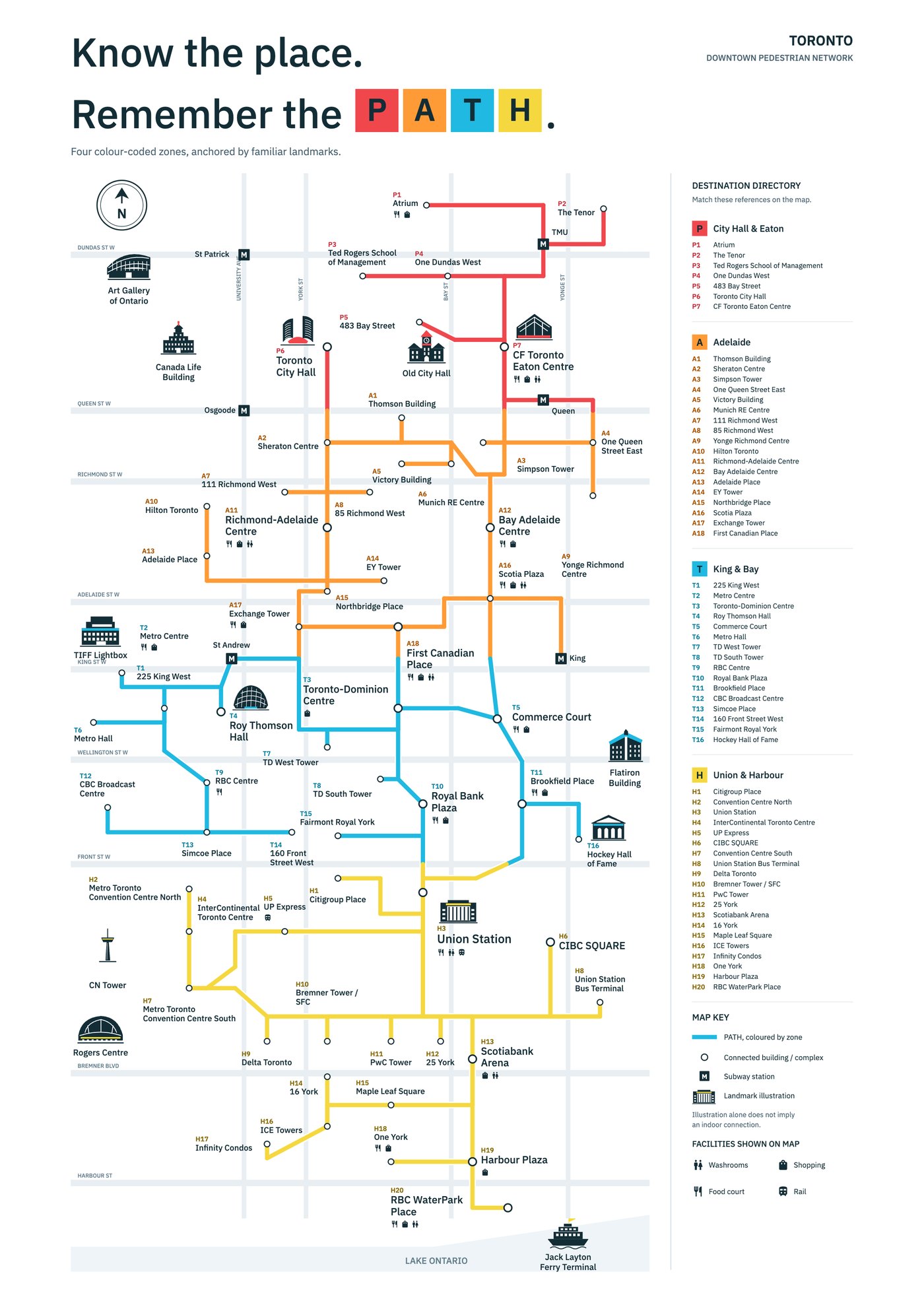
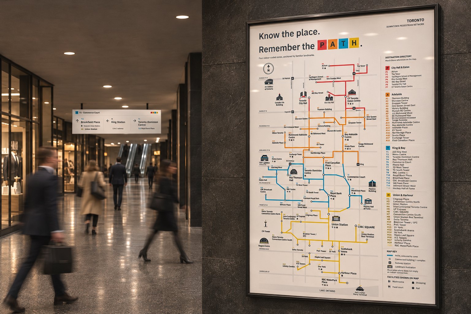
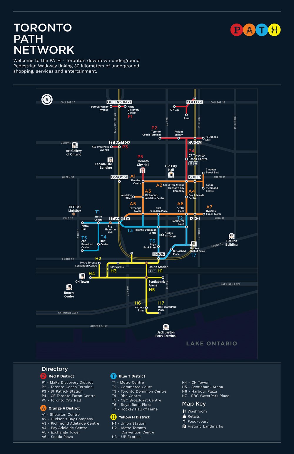
I wanted people to be able to build a picture of the network they can remember. I split PATH into four colour-coded zones, drawn from the letters P, A, T and H. Landmarks and building names are the anchors, and numbers connect each destination to a shared directory.
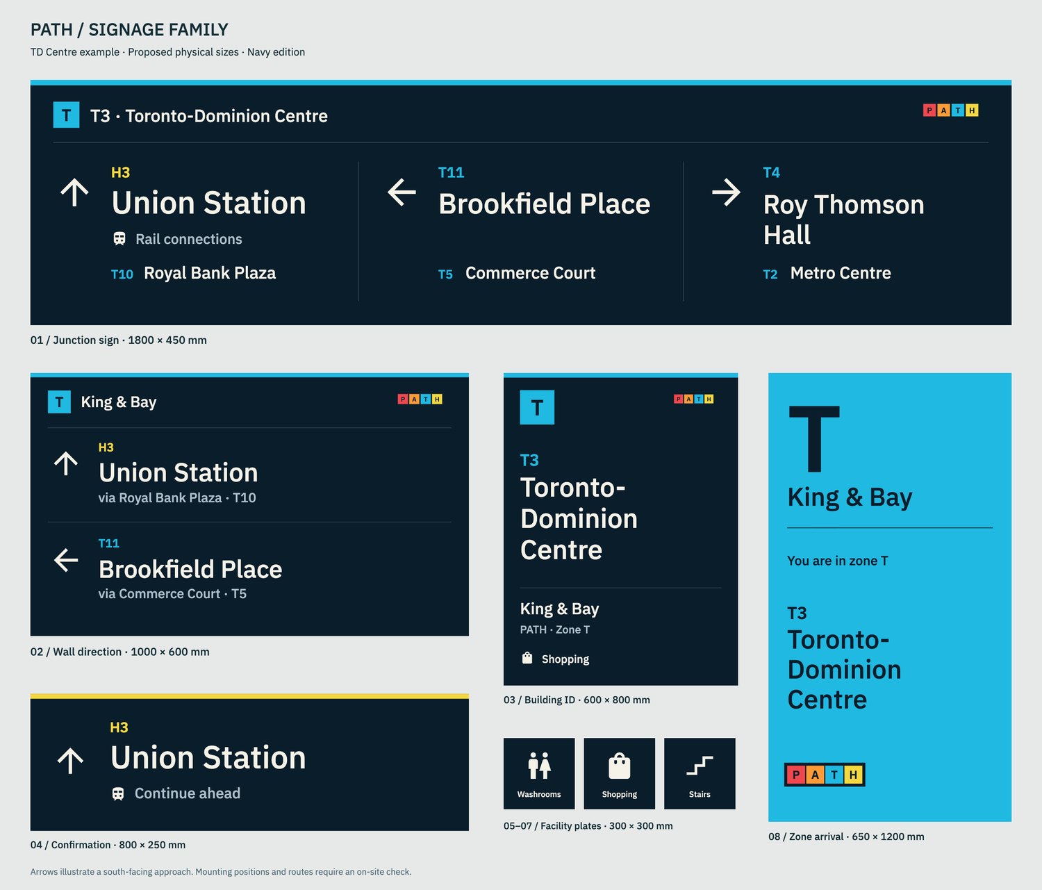
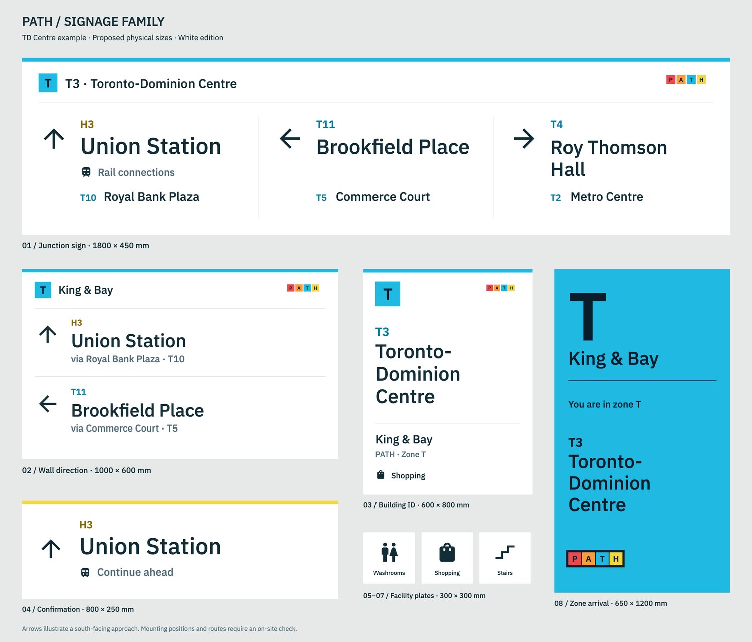
The same colours, names and numbers run through the junction signs, confirmation signs, building IDs and facility plates, so the map and the building speak the same language.
In 2026 I came back to it. I refined the type with IBM Plex Sans, switched to filled Google facility symbols that sit closer to the original pictograms, and made navy and white editions of the map and signs to see how they hold up against different walls.
Where AI fits
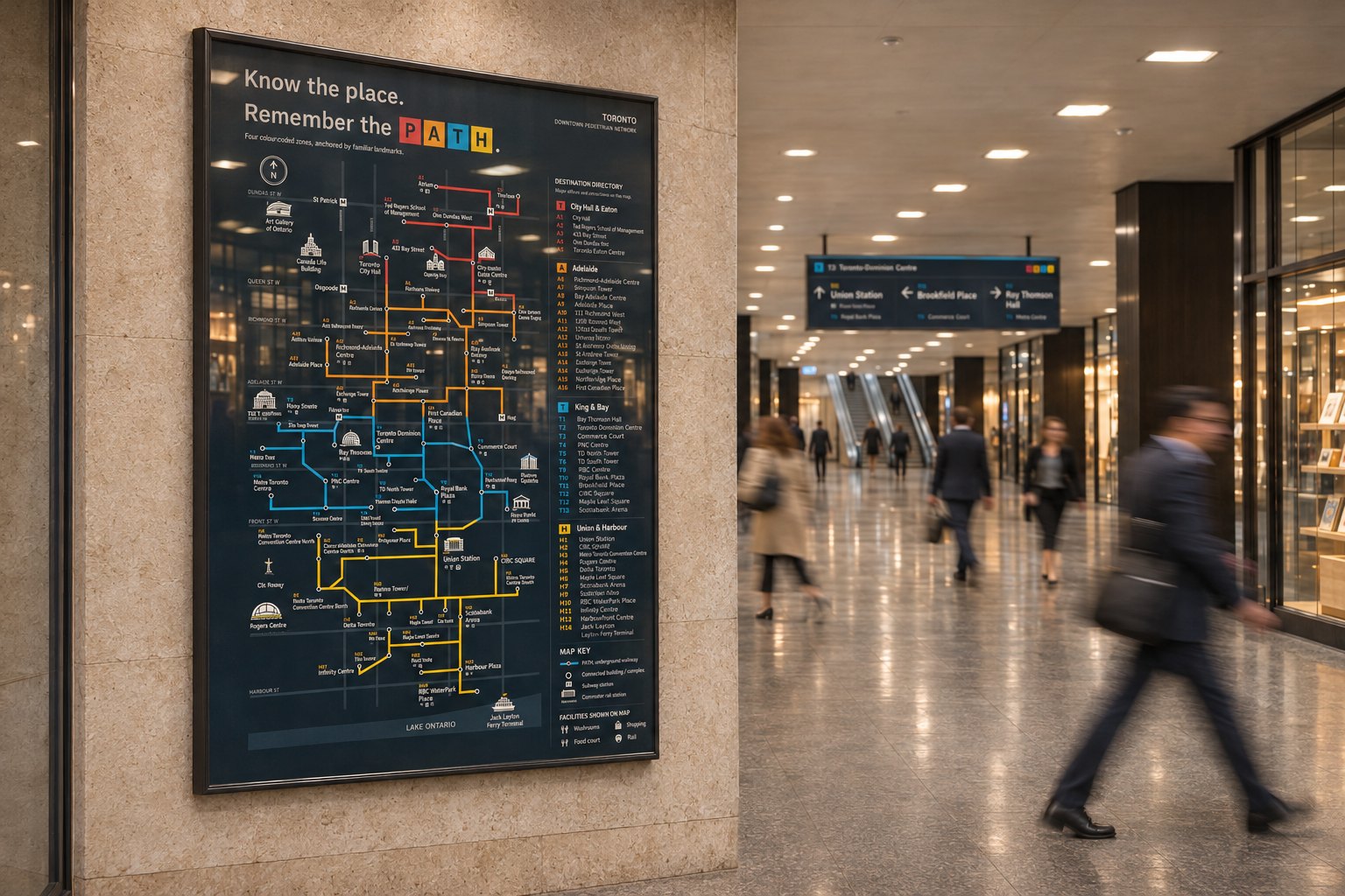
The 2020 research and original design were done by hand. In 2026 I used AI to check references, for parts of the production, and to make the two concourse images in this case. Those two are generated visualisations, not photos of anything installed.
The result
There are three ways to get your bearings: spot a landmark, remember a zone, or look up a building. Confirmation signs reassure you after a turn.
I have not field-tested the 2026 version, and the sign sizes are proposals, not surveyed sizes. Treat this as an independent design proposal.